
Finding Who Lives on a Solano County Street
A street search in Solano County is an address workflow, not a single name lookup. Start with the parcel or situs address, record the APN and legal description, then follow the owner or indexed party through the sources that fit the question. The assessor and ReGIS can connect a location to land. The Recorder can connect a name to a deed or lien. Permits can date work at an address. A directory or permitted voter-file extract may add a household clue, but neither is complete.
- Run the address through the Solano Property & Assessment Search and copy the APN, situs, owner or mailing field, and legal context shown.
- Open the matching application in Solano ReGIS, select the parcel, and note the city, county, district, or unincorporated jurisdiction.
- Use the California voter process only for the person's own status or a permitted file request, not as a casual street roll.
- Search the Recorder search FAQ and index by grantor, grantee, date, and document type.
- For an older address, compare reverse directory entries, census households, permits, newspapers, and maps.
Solano County Assessor Fields by Address
The county Assessor Division resources and Assessor/Recorder service hub point to the Property & Assessment Search, the first stop when a street number is known. A parcel result commonly supplies an APN, situs address, legal or subdivision context, assessed land and improvement values, and tax-rate-area geography. The public web view does not conclusively expose an unrestricted owner-name search. If the viewer omits a nonconfidential assessment field, the Assessor can be reached at assessor@solanocounty.com or through the counter.
Keep the situs address and mailing destination in separate notes. Situs means the physical parcel. Mailing means where an assessment notice goes. A mismatch can suggest an owner who receives mail elsewhere, but it does not identify a renter or prove who was present on a given day.
| Portal field or control | Type | Street-search use |
|---|---|---|
| Address | Text or geocoder | Starts a situs search when the APN is unknown |
| APN | Text | Preserves the parcel key for later deed and permit work |
| Map or legal context | Result fields | Connects the street number to a subdivision or lot |
| Owner or mailing field | Displayed field or office request | Offers an owner clue where the public interface discloses it |
| Values and tax-rate area | Assessment context | Helps distinguish parcels with similar street numbers |
Solano Property & Assessment Search is the address-keyed entry point. The official parcel-map viewer is a second map entry point when the address needs a visual check.
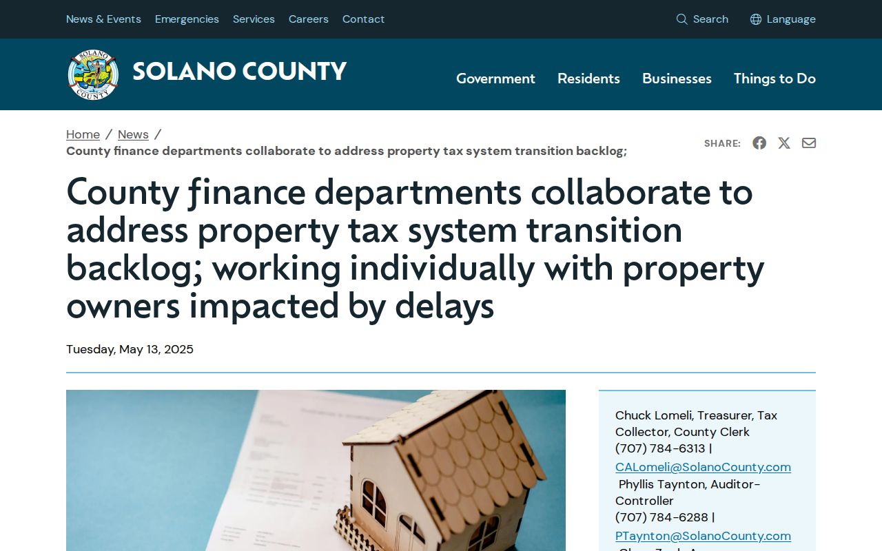
The property-tax system transition notice is a reminder to compare current and prior values and to verify a confusing result with the county office.
ReGIS Street Browse Across Solano County
ReGIS joins parcel geometry to the county's unusual mix of city, rural, district, and military geography. Its partner directory includes the seven incorporated cities, Solano County, LAFCO, water, sewer, flood, irrigation, and transportation agencies, plus Travis Air Force Base. A street-by-street walk can therefore reveal why a permit or planning question belongs to a city rather than County Resource Management.
In a parcel application, search the address or APN, zoom until lot lines are visible, click the polygon, and open its attributes. Use the layer list, basemap, legend, and any enabled measurement or print controls only for orientation. The dynamic applications do not expose one stable official HTML field list, so record the application name and date of access with the result.
The county's Parcel Viewer application record supplies another metadata trail for the map item; it does not turn a dynamic map into certified title evidence.
Solano's recording-notification program shows the APN handoff used when a deed, quitclaim deed, or deed of trust is recorded.
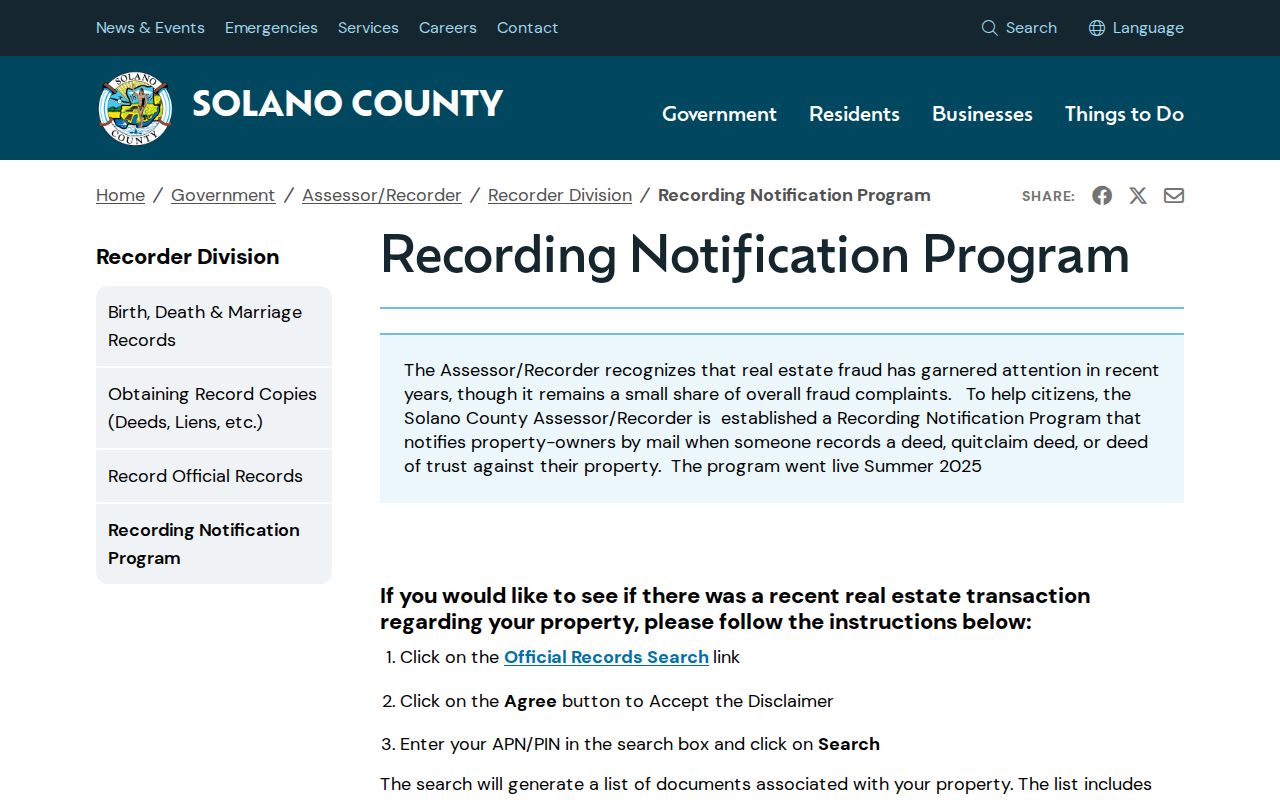
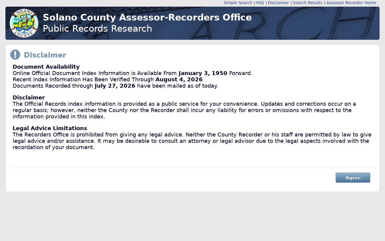
The recording-notification workflow also starts with an address, but it uses the APN as the handoff into the Official Records Index. It can show a recording date, parties, and document type without supplying document images.
Solano County Deeds Without an Address Search
The Recorder's FAQ is the local quirk that shapes every street directory search: street addresses are not stored in the Official Records index. Search the current owner as a party, narrow by date, and choose a deed, assignment, reconveyance, lien, or release term. Then compare the legal description and APN before treating the result as part of the street chain.
The online and office-computer index reaches 1955 to the present. For 1954 and earlier, the office research area is the fallback. The Recorder retains documents permanently and describes them as generally public, but an index result is not the same as a certified copy. A copy costs $9 for the first page and $1 for each added page; certification adds $5.
The Solano Recorder search FAQ states the address limitation and the party-search method.
That explicit limitation is why the APN and legal description should travel with every note, even when the street number seems stable.
Solano Recorder copy instructions show the office route for a document that needs more than an index entry.
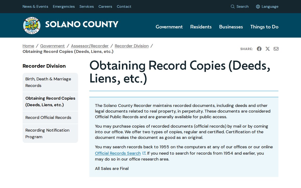
The copy channel turns a street-directory lead into a document request while keeping the recorded instrument tied to its custodian.
Solano County Records Searchable by Street
Several Solano County records are keyed to an address or parcel, although their fields do not all describe the same person. An assessment roll can identify an owner or mailing destination. A ReGIS layer can show adjacent parcels and jurisdiction. A permit can name an applicant, contractor, owner, work type, and date. The Recorder's index can show a grantor, grantee, lien, release, deed, or map event. A voter-file request is narrower and governed by California election law.
| Record Set | Keeper | What It Shows | Access |
|---|---|---|---|
| Assessment roll and parcel map | Solano Assessor | APN, situs, map context, values, disclosed owner or mailing fields | Web map, email, or counter |
| ReGIS parcel layers | Regional GIS partners | Geometry, adjacency, city or unincorporated status, districts | Free dynamic viewer |
| Deeds, liens, and releases | Solano Recorder | Indexed parties, document type, date, number, legal description | Free index; copies by request |
| Permitted voter file | Registrar of Voters or Secretary of State | Registration or precinct fields for an approved purpose | Restricted application |
| Permits and code records | City or County Resource Management | Address, work, dates, applicant, owner, contractor, outcome | Portal or CPRA request |
The APN is the bridge. The street name is helpful for orientation, but the legal description is often more stable than a street number. A map polygon is not certified title. An owner mailing address is not a resident list. A deed is not proof that every occupant lived at the address. The phrase street directory is useful only when the source's scope stays visible.
- Parcel
- A mapped unit of land identified by an assessor parcel number.
- Situs address
- The physical location of the parcel, distinct from a mailing destination.
- Plat
- A recorded map showing subdivision or lot relationships that can anchor a street change.
- Criss-cross directory
- An address-order or street-order listing that can turn a historical place into listed names.
Solano County Permits by Street
Permits add an address-dated layer to a street directory. Incorporated parcels route to the city that supplies the permit portal. Unincorporated parcels go to County Resource Management at 675 Texas Street, Suite 5500, Fairfield; Building Permit Inspection is listed at 707-784-4750. Permit records may connect an address to an owner, contractor, application date, issue date, final date, valuation, and work description.
Vacaville's permit history reaches 1990 to the present and requires an account with all registration fields completed. Plans cannot be copied or printed without design-professional permission. Vallejo eTRAKiT accepts a permit number, contractor, or site address. For a Vallejo address, omitting the street type, such as using a number and street name, can broaden a search with the Contains operator. Active code-enforcement details may be restricted; closed notices and final dispositions are better CPRA targets.
A permit is evidence of a project, not a full household roster. Compare its APN or legal description with the assessment and deed trail.
Solano County Mailing Versus Situs
Street research often carries two address fields that answer different questions. Situs is the physical parcel location used for assessment, mapping, and many permit searches. A mailing address is where an owner or responsible party receives correspondence. The two can differ when an owner is absentee, a tax notice uses a separate destination, or a rural parcel is described by a route rather than a subdivision number.
| Situs address | The location of the land or improvement; use it to locate the parcel polygon and jurisdiction. |
|---|---|
| Mailing address | A correspondence destination; it may be outside the parcel and is not an occupancy finding. |
| Legal description | Subdivision, lot, block, or metes-and-bounds language that can remain stable through street changes. |
For a street directory, copy each field exactly as the custodian displays it and label the source. Do not turn an owner mailing address into a neighbor, renter, or resident conclusion. If a street number conflicts with the legal description, ask the Assessor or GIS custodian to reconcile the parcel before following a deed chain.
Solano County Reverse Street Directory Pages
A reverse or criss-cross directory can turn a historical street address into listed names, but it is a different record layer from the current assessor and Recorder tools. Solano County's directory and telephone holdings are discontinuous by community and year. When a volume has a street section, record the title, publisher, edition year, page, and abbreviation key before treating a listing as a household clue.
- Start with the exact historic number and street spelling, including any route or rural description.
- Check the reverse or address-order pages, then compare the same name in the alphabetical section.
- Compare adjacent editions and census years; a missing entry may reflect a gap, non-subscription, omission, or renumbering.
- Corroborate the listed address with a deed, permit, newspaper, cemetery, or probate record held by the appropriate custodian.
The result is a dated lead, not a complete occupant roll. A current street directory search should hand historical names to the Solano County city directory collections workflow, where a librarian or archive can verify the physical volume.
Solano County Street Names and Land Descriptions
Street numbers are convenient, but they are not always the oldest key in Solano County. Rural Dixon, Rio Vista, and Delta records may use a route, ranch, township, school, irrigation district, or legal land description. An early parcel can also sit under a different postal community or municipal jurisdiction than the one used today. Preserve the APN, subdivision, lot, block, and legal description whenever a map or assessment result supplies them.
That continuity matters when a street directory search crosses an annexation, subdivision, or historic address change. Compare the current parcel polygon with recorded maps and permits. A Sanborn sheet or reverse directory can help explain a changed number, but it is a historical clue rather than a certified boundary. When the street trail reaches an old household, switch to the historical collections and census records instead of forcing an old name through a modern address field.
What a Solano County Street Directory Cannot Show
A Solano County street directory cannot supply a complete list of people who sleep at an address. Assessment fields concern land and ownership. A recorded deed concerns parties to an instrument. Permits concern a project. A voter-file extract, if approved for a permitted purpose, concerns registered electors and can omit people by design. Renters, household members, utility customers, and delivery records are not a public countywide roll. DMV address data is restricted by the federal Driver's Privacy Protection Act.
California's Safe at Home program can shield qualifying participants through a substitute mailing address. Court, voter, assessor, and recorder redactions can also create intentional gaps. A missing name should lead to a question for the custodian, not a guess about an occupant. The full named-street chain belongs in the street directory workflow; a one-person identity question needs a separate records comparison.
Lawful use. Solano County address records are useful for family history, property curiosity, civic research, and reconnecting. Using a street or address trail to stalk, harass, intimidate, or harm anyone can violate California law, including Penal Code §646.9 and Code of Civil Procedure §527.6.